Join us this Fall in getting out and trying new adventures! Not sure where to start? We’ve got some tips for you.
Hiking is a fun way to get outside and try a new outdoor activity. With so many trails and places to explore, you’ll feel like a pro in no time! As you prepare for your adventure, use our tips below to help you prepare for your first fall hike!
Choose the right route. As a first-time hiker, you’ll probably want to start small. It’s also important to select the right trail for your fitness and adventure level. There are plenty of resources to help you find the perfect trail for you! Check out a guidebook or hiking website, ask your friends, call a ranger station, or contact a local hiking organization to learn more about the different trails near you. Part of choosing a trail is also considering how far and high you want to hike. An average walking pace is about 3 mph (5 km/h), but your hiking pace may be slower depending on your trail’s terrain and elevation.
Familiarize yourself with the trail. Once you’ve got your trail picked, make sure to learn a bit about it before you head out! Find and print a map of the area, and check what’s nearby. Is there a rangers’ station or picnic area? What about scenic peaks or lakes? You also may want to call the park office to determine if you need a hiking permit and for any preparation recommendations specific to that trail.
Check the weather and trail conditions. In the days leading up to your hike, make sure to check the weather and trail conditions. Then, check again in the hours before. This information will help you decide exactly how to dress and what to pack. It also will tell you if you need to reschedule due to unexpected bad weather. Keep in mind, if you’re hiking toward a higher elevation, the weather conditions may be drastically different than at the trailhead or a nearby town. Additionally, trails can close occasionally for repair. It’s always a good idea to call the park before you leave for your hike to check all conditions.
Dress up! You can get hiking gear at any local sporting goods store! The key is to get the right hiking shoes (and socks!) and bring layers. If you are hiking up in elevation, it is especially important because the weather can change so dramatically. Skip cotton clothes – they can get damp and uncomfortable. Instead, opt for synthetics or exercise gear. When it comes to your hiking shoes, there are many options – so do your research and ask around! Wool or synthetic socks will help keep your feet comfortable, but you’ll probably also want to bring blister dressings, just in case.
Pack the essentials.
Navigation (paper or sat device)
Iridium® satellite navigation and tracking device. Click here to view some of our partner products and find a retailer near you.
Sunscreen
Water (Make sure to check the availability of water on your trail. If there is none, bring extra!)
Flashlight
First Aid (Click here to find an REI Wilderness First Aid Class near you!)
Knife
Lighter
Dried fruit, nuts, or an energy/protein bar.
Bug spray (depending on location)
Tell someone where you’ll be. If you’re planning to hike alone, it is important that someone else know where you’re going and how long you’ll be gone. Leave your plans with a family member or friend. Also, it’s a good idea to keep a note with your route plans inside your car, in case a search-and-rescue team needs to come looking for you. (Make sure you don’t leave it in plain sight, though, for “trailhead thieves” to see!)
When hiking alone, it’s also smart to bring a satellite-enabled emergency device. Many Iridium partners offer small devices that work anywhere on the planet – even in remote areas, like hiking trails, where your cell phone won’t connect. There are several options powered by the Iridium network, ranging from simple one-way emergency SOS devices, to small two-way communications device with SMS texting features, as well. Click here to browse our partner products and find a local retailer who can help you through your purchase.
Leave No Trace Before you head out, familiarize yourself with the seven principles of enjoying the outdoors in a sustainable way.
Plan ahead and prepare.
Travel and camp on durable surfaces.
Dispose of waste properly.
Leave what you find.
Minimize campfire impacts.
Respect wildlife.
Be considerate of other visitors.
Have Fun! Now that you’re ready for your hike, it’s important to be prepared and stay safe – and most importantly, have fun!
Today Iridium team members from all around the world are headed to Nashville, Tennessee, where we are hosting this year’s Iridium Partner Conference (IPC). Our 12th IPC comes at an exciting time for us and our over 400 value-added partners, as we near the completion of the Iridium® NEXT mission and move closer towards the introduction of Iridium CertusSM.
Together this year, we’ve surpassed 1 million active subscribers on the Iridium network and successfully launched 25 more Iridium NEXT satellites (with only one more launch of 10 satellites to complete our new constellation) – and we’ve still got so much more ahead of us! Our partners provide specialized knowledge in their industries to manufacture, develop, market, and support connectivity solutions on the Iridium network, enabling people and ‘things’ around the world to communicate. Their innovative solutions range from providing safety services to tracking aircraft data, monitoring ocean levels, observing wildlife behaviors, linking first responders and aid workers, connecting soldiers to their families, and enabling remote or autonomous workforces…to name just a few!
As we near the end of the Iridium NEXT launch program and look to the future, the new Iridium network will supercharge our partners’ solutions around the world, providing faster speeds and greater capabilities. We’re already supporting new data-driven applications, IoT innovations, and other unique services that wouldn’t be capable on traditional networks. The possibilities are endless, and together with our growing partner ecosystem, we will continue to connect the world and change the future.
We’re excited to spend the next few days with our partners, fostering relationships across industries, learning from one another, and looking to the future – and if we’re lucky, maybe we’ll spot a famous country singer or two!
To learn more about our Partner Ecosystem, click here or check out the Launch 7 video showcasing the work of our partners below.
Guest Blogger: Dan Rooney, Director of Maritime Business
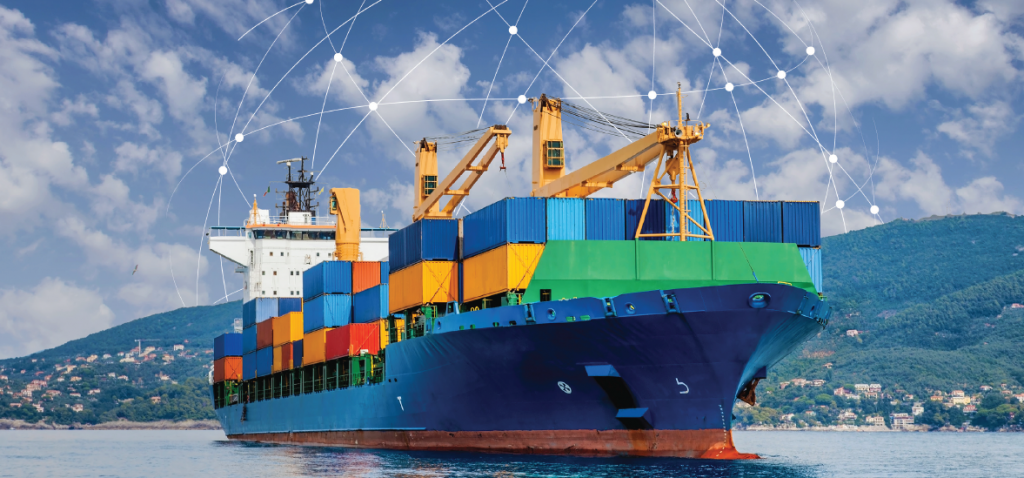
Looking at the different verticals Iridium serves, these markets often have very similar connectivity requirements. For example, compare a heavy machinery mining truck to shipping containers, or wind turbines to an aircraft. These assets use the same Iridium® technology to transfer big data, either as the primary connection, or as part of a hybrid solution augmenting other technologies such as GSM, LTE, or LoraWAN.
There are many definitions of Big Data. It’s a common misunderstanding to believe that big data requires big bandwidth, and therefore VSAT is the only available option; however, there are other considerations at play beyond just bandwidth. These considerations include location and size of a device, its cost, urgency of data transfer, etc. As digitalization in shipping progresses, we are witnessing an exponential growth in the number of IoT applications. This, in turn, drives the requirement for greater bandwidth. Yet, many IoT devices reside on ships, thus reducing the frequency and amount of data communications, ensuring that only required data is exchanged between ship and shore.
At Iridium, we see IoT, Big Data, and Block Chain as technologies that the maritime segment will embrace, bringing cost savings and greater insight. Digitalization will be powered by a multitude of connectivity options – for example hybrid networking. Iridium CertusSM is in a unique position to become the smart grid of maritime IoT. Iridium Certus delivers Big Data and IoT to shipping companies across the globe, at the lowest uniform latency powered by small form factor maritime grade equipment.
Guest Blogger: Wouter Deknopper, VP & GM Maritime Business
The 1980’s was an influential decade that brought significant changes to the world. The maritime industry didn’t escape these changes, specifically with a technological leap from Medium, High, and Very High Frequencies (MF/HF/VHF) radio communications on-board to L-band satellite equipment. Housed in 100 kg white domes, these devices provided voice and telex to deep-sea ships at a rate of $20 per minute for a phone call. In these days, a ship owner’s choice of satellite communications was easy. As Henry Ford used to say when he the launched the Ford Model T, “You can buy the car in any colour as long as it’s black.” This glib statement reflects the solitary choice that ships had. There was only a single satellite network for ships, and Safety of Life at Sea (SOLAS) regulations dictated that deep-sea vessels must have it installed. This created a monopolistic environment, where the satellite operator dictated market rates without challenge. With the introduction of VSAT technology and Iridium® services, this de-facto monopoly situation started to evolve after 2000.
Fast-forward to the current decade, the maritime communications marketplace has significantly evolved, with a myriad of technology options powered by different frequency bands, namely L, Ku, C-bands, and, as of late, Ka-band technologies. What is the “best-fit” for ship owners and operators? Do they have more choices or too many choices? Each Satellite Network Operator (SNO) claims that their network is the best-in class. This creates a general market perception of an epic “Battle of the Bands” and a complex choice of satellite communications for the maritime segment. Is one solution really superior to the others? Can any SNO claim that the maritime market is a one-size-fits-all environment? In reality, there is not a single maritime market, but rather many different requirements and connectivity options.
With Iridium CertusSM enabled by the Iridium NEXT network, ship owners and operators now have a choice for L-band communications. Iridium Certus provides superior data speeds that are delivered by non-moving lightweight antennas manufactured by the world-class manufacturers Cobham and Thales. Iridium will revolutionize the L-band spectrum, establishing Iridium Certus as the new gold-standard in maritime communications.
So, what about our battle of the bands? For ship owners and operators who strictly need L-band solutions, Iridium is undoubtedly the way to go. Meanwhile, for ship owners and operators investing in VSAT technology, Iridium offers the ideal companion solution with dependable, weather-resistant, pole-to-pole connectivity, cementing Iridium as the de-facto companion L-band solution for the world’s leading VSAT providers.
Learn more about what Iridium Certus can offer you at www.IridiumCertus.com.
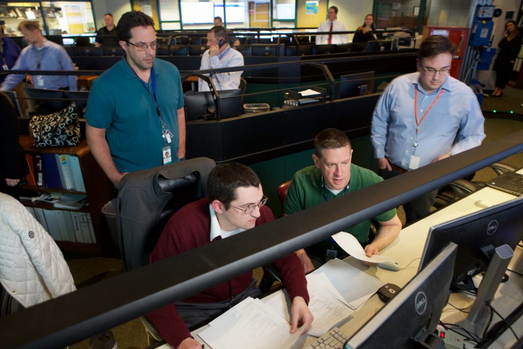
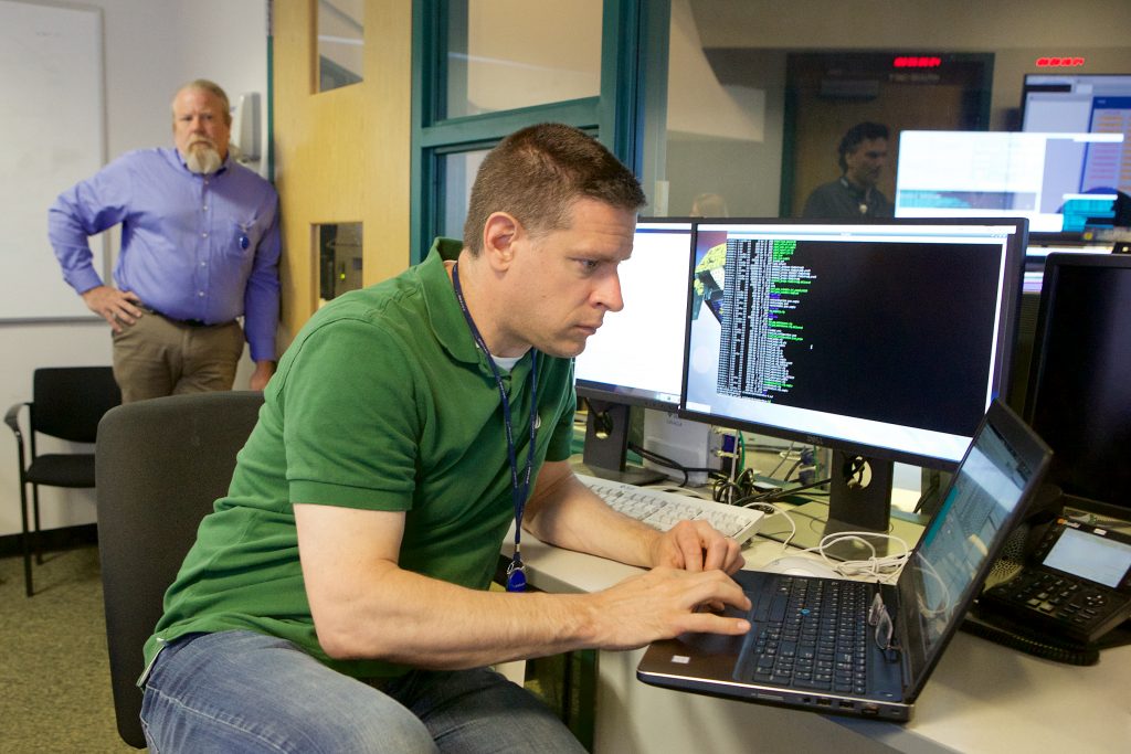
Ever wonder what it’s like to work at our Satellite Network Operations Center (SNOC)? Satellite Systems Engineer Ken Rock took us behind the scenes in August, giving us a peek at the typical types of engineering and operations activities he encounters at the SNOC in Leesburg, Virginia. In this post, he shares the ins and outs of ensuring that Iridium® satellites perform optimally, allowing our network to continue providing global coverage for our subscribers all around the world.
Nine O’clock Operations Coordination
We are starting the week discussing current progress on Launch 7 slot swap, software loads, service activations, de-boost, and other activities we’ll undertake for the next several days. There is a lot going on at the SNOC, so in attendance were participants from every team. It is amazing how much information is exchanged in this meeting, yet it runs very smoothly since we’ve been conducting this meeting daily since Launch 1. Today, we see that SV153 is arriving at Plane 1 after a long drift. We will be working on maneuvers to stop the drift and ascend to mission, as well as complete particular activities to prepare a few satellite vehicles (SVs) for de-boost. We have to work quickly, though, because we want to accomplish these tasks before the SVs drop out of crosslinks. My team is also preparing for new satellite flight software – we need to get the software onboard, and then methodically test it to make sure it is working properly. The initial upload was planned to take place on a storage satellite, but we recognized an opportunity to load the software onto a mission SV. Using this other satellite will streamline the overall activity. Several offline discussions will happen to coordinate with the Planning, K-band, Systems, and Platform Software (PFSW) teams.
Preparing SV056 (Block 1) for its Last Software Upload New flight software requires a compatibility procedure be run prior to resetting the computer, so we had to build, check, and execute that procedure with the Ops floor. The new software provides advanced de-boost capabilities to safely lower the satellite’s orbit and passivate the vehicle. We want the SV to re-enter the Earth’s atmosphere in a predictable manner, with no propellant onboard, Solar arrays in a high-drag configuration, and batteries depleted. This is how we ensure the satellite is de-boosted safely and we contribute to reducing space debris (or “space junk”), sustaining space for the future.
Reviewing De-boosting SV Performance On the topic of de-boost, three SVs are currently in various stages of maneuvers. The Attitude Control Systems (ACS) and Orbit Analysis (OA) teams have automated data collection and processing performed many times per day. Data is processed, and a data package generated and emailed to team members, so they can follow along with the progress each SV is making. I like to check the orbit apogee and perigee, the fuel remaining, and the attitude transients encountered.
Lunch & Learn: Operations Julian Horvath, an Operations Systems Engineer from our RimRock facility in Tempe, Arizona was kind enough to host a Lunch & Learn session for our SNOC interns. He discussed cost/benefit trades for engineering versus operations, and provided some insight on how work is divided between Iridium and our Iridium NEXT mission partner (and Iridium NEXT satellite manufacturer) Thales Alenia Space. One of the interns asked about how work varies at different-sized companies. Julian shared that when working at a company like Iridium, there is a lot of responsibility, but also a lot of opportunity.
Event Monitoring I was asked by Ahsen Abbasi, Senior Technical Manager of Real-Time Operations, to monitor how many events of a certain type were expected per day. Currently the Ops team manually runs a procedure for each event, and recently had seen a slight uptick in occurrences. I queried data from several weeks of our vehicle reports and observed about 8 to 10 events per day. For 65 satellites in orbit, this is about the number I expected, although it was much fewer when we only had only 20 Iridium NEXT SVs on orbit last year. In our next version of software, these events are handled autonomously, so the Operations team will not have to respond. Interestingly, this event is correlated with space weather. As it turns out, a solar coronal hole has rotated towards Earth over the last few days, according to Spaceweather.com. Just today, the solar wind is arriving at Earth, and particles are interacting with our satellites. This is all normal – we just don’t see these space weather reports here on Leesburg TV, but this weather may trigger some nice auroras near our ground stations in Alaska, Yellowknife, or Svalbard.
Counting Bit Errors We audited single bit errors for Satellite Platform computers recently. We trended all SVs and cumulatively plotted the number of error per SV per day. It was nice to see a linear plot of this data, indicating no degradation in memory over time. It was also interesting to see that small differences in orbit altitude affect the rate of bit errors (fewer errors at lower altitudes). One of our SNOC interns created a MATLAB tool that captured telemetry changes and plotted them over top of a world map. We expected to see most bit errors occurring over the South Atlantic Anomaly (SAA), but it was amazing to see such a tight grouping of data! Our counterparts at TAS are also tasked to review this data as part of on-orbit checkout. Data access has already been approved for them, but they do not have direct access to it, so we query the data and send it to them.
Collecting External Hosted Payload (HPL) Data All of our Iridium NEXT satellites have a Hosted Payload (Aireon) onboard. Those payloads have a dedicated ground system to manage their operation, which was built in parallel with the primary Iridium satellite ground system. We recently identified an opportunity to improve operations by allowing these systems to better share information. Since Launch 1, we’ve always stored 30 days of historical HPL data that was available to process, but in order to analyze it, we had to dig into our long-term archives. When we retrieved the data, we found it stored in three different formats that had changed throughout development. We wrote a script to parse and format the data into a common intermediate format. Another script was written to process that data and add it to our databases. The next step will be to automate the entire data collection and integrate this process into standard ground system processing.
AMPERE NEXT Ground System Performance AMPERE NEXT is a data program for The Johns Hopkins Applied Physics Laboratory (JH/APL). They are analyzing magnetometer sensed magnetic field perturbations and inferring electric current flow in the Earth’s Magnetosphere-Ionosphere. I have been refining the data processing system for AMPERE NEXT for the past several months. Generally, the data processing works well and sends data to JHU/APL within minutes of acquisition on the ground, but today I found a small gap in the data – about 350 samples (out of 10,800) were missed during real-time processing, and filled in shortly after during post-processing. I spent some time searching for the root causes of the data gaps, then made some notes and recommendations for code changes that will allow the system to avoiding this kind of gap in the future. I also spent some time writing a data archiver script for this data, as archiving has previously been done manually. The script was simple, in that it would “zip up” some data on one day, then move other “zipped” data to long-term storage. I tested the script on data that needed to be archived, and manually executed the script on a day that needed to be zipped/moved. I then wrote a change request to officially release the script and add it to scheduled processing for automatic execution. I was able to catch a few members of the Control Facility System Operators (CFSOs) during lunch to discuss the AMPERE processes. After lunch, I added content to new AMPERE NEXT training packages that were co-developed with Aaron O’Connell, one of our SNOC interns. Aaron was able to brief the training package to one of the four Real Time Operations (RTO) crews today. We’ll get another crew tomorrow, and the final two next week. Training for the AMPERE NEXT ground processes will be more important, as we begin to hand over control to RTO, who will support these ground systems tools 24×7 for years to come.
SV166 Computer Reset Computers in space reset just like any other computer, but when those computers are satellites flying through space that, together, are worth over $3 billion, we look a little closer at the root cause. This involves analyzing any observed error codes, memory dumps, and satellite telemetry. We happened to be completing the reset while TAS engineers were still involved in SV checkout, so they were able to participate in the discussions and analysis. This type of analysis can get very detailed very quickly, especially when looking through software memory maps…and once you are in there, you find all kinds of interesting things to learn about, like reviewing executable assembly code, breaking out software binary files, analyzing data header structures, etc. In the end, we determined this event to be a single event upset (SEU), which is a random upset. This SV is destined for mission!
Thank you to Ken for giving us a peek into what a day in the life of a Satellite Systems Engineer looks like!
For decades, people across the government and the private sector have debated whether Low-Earth Orbit (LEO) or Geosynchronous Equatorial Orbit (GEO) satellites are more effective at providing communications. Price, coverage, maintenance, and a variety of other topics are continually discussed around the world as technology continues to advance. This blog will help you understand the different types of constellation architectures and how they work.
Let’s start with Geosynchronous Equatorial Orbit, also known as Geostationary satellites. These satellites are called Geostationary because they appear fixed as they move at the same angular velocity as the Earth and orbit along a path parallel to Earth’s rotation, providing coverage to a specific area. From the ground, GEO satellites appear to be, well, stationary. At about 35,000 kilometers (22,000 miles) above the Earth’s surface, this type of orbit was first used in 1964 for NASA’s Syncom III, an experimental satellite for communications aboard the Delta-D rocket. Unfortunately, due to the curvature of the Earth, a geostationary satellite cannot provide continuous service above or below approximately +/- 70 degrees latitude.
Meanwhile, LEO satellites revolve at an altitude between 160 to 2,000 kilometers (99 to 1,200 miles). A constellation of LEO satellites can provide continuous, global coverage as the satellite moves. Unlike GEO satellites, LEO satellites also fly at a much faster pace because of their proximity to Earth. For example, an Iridium® satellite flies at approximately 17,000 mph (completing an orbit every 100 minutes!), compared to a GEO satellite that typically flies around 7,000 mph.
There are many applications for GEO satellites, including weather forecasting, satellite radio, and television. Because GEO satellites orbit at such a high altitude, however, there is a longer communication time lag (latency) as the signals travel to and from these satellites. For this reason, many critical communications are handled over LEO satellite networks, which allow for faster connectivity without wires or cables.
Although the first LEO satellite was launched in the 1950s, it wasn’t until the 1980s that engineers began to challenge the effectiveness of GEO satellites and their “bent pipe” architecture (that many LEO satellites had adopted too). That’s when the idea for a LEO satellite constellation first occurred. A small group of engineers at Motorola began researching and designing a LEO satellite system that allowed the satellites to communicate with each other through cross-links, making for low-latency communications possible all around the world. This network would eventually become Iridium. This crosslinked architecture provides the additional advantage that communications can be “grounded” near their desired destinations.
Today, many communications, navigations, space mission, and observation satellites are in low-earth orbits. Among these are the International Space Station, which orbits at an altitude of around 350 kilometers (218 miles) and the Iridium network, which includes our constellation of 66 active satellites orbiting at 777 kilometers (431 miles) above Earth.
The Iridium network’s LEO position allows us to serve many markets that struggle to adequately communicate with a GEO system. For example, our LEO constellation enables uninterrupted communication anywhere in the world – even for ships sailing at high latitudes, adventurers in remote regions, or transoceanic planes far from land. Due to the fixed nature of GEO satellites, signal blockages between a user and satellite can easily occur; however, since LEO satellites are always moving, the chances of a long or persistent signal blockage are greatly reduced.
Additionally, LEO networks, like Iridium’s, traditionally are L-band systems, which operate in the lower part of the radio spectrum, around the same frequencies as mobile phones. Meanwhile, higher frequency C, Ku, and Ka band systems are used for satellite TV and VSAT networks. L-band is renowned for its ability to send and receive transmissions even in adverse weather conditions because lower frequencies are less susceptible to interference from atmospheric and weather conditions than their Ku, Ka and C-band counterparts.
The cross-linked LEO architecture of the Iridium network also enables low-latency, resilient voice calling. Regardless of where a user is, anywhere on Earth, from the North Pole to South Pole, the Iridium LEO constellation ensures dependable communications with a quality user experience.
As we near the commercial service introduction of Iridium Certus, we are confident that this service, enabled by our new Iridium NEXT LEO constellation will become the preferred provider of global communications.
Interested in learning more about how the Iridium network uses our LEO constellation across other markets to provide pole-to-pole communications? Click here to learn more from an interview with our chief executive officer, Matt Desch.
Guest Blogger: Wouter Deknopper, VP & GM Maritime Business
Oceans underpin all life, and support millions of livelihoods. Keeping oceans safe is important for both humans and our ecosystem.
Most ships use Heavy Fuel Oil (HFO) as their fuel. When burned, HFO produces high amounts of Nitrous Oxide (NOx) and Sulfur Oxide (SOx) emissions, in addition to Carbon Dioxide (CO2). Pollution from ships is a major concern, but one that has been largely overlooked. Shipping currently accounts for roughly 2.5 percent of global CO2 emissions, and with unchanged behavior in the industry, experts predict this figure could rise to 20 percent of emissions by 2050.
Alarmed by these numbers, the world’s shipping industry joined the International Maritime Organization (IMO) in an initiative to tackle climate issues and reduce greenhouse gases by at least 50 percent by 2050. The European Union (EU) has taken a prominent position in the fight against growing greenhouse gasses from the shipping market, recently introducing a new regulation which mandates large ships to monitor, report, and verify their emissions within EU waters. These reports are colloquially known as “NOx/SOx” reporting. Additionally, ships operating within EU, U.S., and Caribbean waters must use HFO that is lower in sulphur, which in turn will produce less SOx emissions.
The environmental impacts of global shipping also extend beyond fuel pollution. Discharging of ballast water from ships around the globe has led to invasive species of marine organisms appearing in foreign ecosystems. In order to better monitor this, regulations also require mandatory treatment of ballast water before discharging, and subsequent reporting to various maritime agencies. This was enacted with the hope that the mandatory reporting, combined with a more environmentally-friendly approach to shipping will greatly reduce the net effects of pollution caused by the shipping industry.
As an increasing amount of ships are transitioning towards digitalization, operating smartly and efficiently is no longer a choice, it’s a necessity. The requirements for efficiency are re-enforced by the low chartering rates that currently affect the profitability of the maritime transport sector. Ships are required to regularly transfer their GPS position, speed, heading, and other navigation details via the Automatic Information Service (AIS), which significantly increases the situational awareness for vessels navigating waterways. AIS has dramatically increased maritime safety since its introduction in 2002, and has enabled vessel traffic to be organized more efficiently. By applying performance monitoring techniques, as well as measuring and implementing existing and new innovative technologies, the maritime industry can greatly assist shipping companies to reduce energy consumption.
The digitalization revolution is truly underway within the maritime sector. Engines, generators, and a plethora of connected industrial equipment can produce real-time performance data. The data can then be sorted as critical or non-critical on board before transmission using edge computing devices. Critical data can be sent ashore in real-time if necessary, then used by the equipment manufacturer for Condition Based Monitoring (CBM), which ultimately allows for predictive maintenance regimes. Together, these two principles reduce the risk of unexpected equipment failures, leading to greater cost efficiencies.
Data can also be provided to third parties via the respective CANBUS interface, allowing for a complete snapshot of a vessel’s efficiency. A ship’s fuel efficiency can be affected by elements external to the engine room. For example, the ship’s hull must be cleaned regularly from fouling caused by maritime organisms, which can increase the drag of a vessel passing through water, and therefore burn more fuel. A Vessel Performance Optimisation (VPO) system will take all of these facts into account and give an efficiency rating to each ship, which defines a baseline for monitoring. Deviations from the baseline can be easily identified and quickly resolved.
So, how does Iridium support a more environmentally-friendly and sustainable shipping industry? The maritime digital revolution can only be enabled through cost efficient and dependable connectivity. Iridium and its global partners have built a wide range of applications and technologies to enable greener, safer, and more secure marine environments. These are reinforced by the Iridium® best-in-class global satellite network. Iridium CertusSM, enabled by the Iridium NEXT constellation, brings new possibilities to the maritime transport sector, breaking the status-quo for L-band connectivity.
The global coverage and low latency provided by Iridium make it ideal for a number of IoT devices and applications. By integrating Iridium technology, IoT devices can independently transfer their data, thus not requiring integration into the ship’s existing communication equipment. Ship business is also enhanced via Iridium Certus, with high-speed, cost-effective data services and three high-definition voice lines available. If a ship can see the sky, then Iridium satellites can see it.
Iridium Certus will be the biggest Global Maritime Distress and Safety System (GMDSS) revolution in decades, expanding and enhancing global maritime safety. Iridium Safety Services will provide truly global, multi-satellite maritime safety for the first time, providing GMDSS coverage beyond traditional L-band services. This includes both distress alerting services and navigational warning services. Iridium Safety Services will create an unprecedented new era for shipping, to help ensure that ships and their crew are safe for generations to come.
To learn more about Iridium Certus maritime offerings, check out the video below and visit www.IridiumCertus.com.
 Guest Blogger: Dan Rooney, Director of Maritime Business
 Guest Blogger: Wouter Deknopper, VP & GM Maritime Business
 Ever wonder what it’s like to work at our Satellite Network Operations Center (SNOC)? Satellite Systems Engineer Ken Rock took us behind the scenes in August, giving us a peek at the typical types of engineering and operations activities he encounters at the SNOC in Leesburg, Virginia. In this post, he shares the ins and outs of ensuring that Iridium® satellites perform optimally, allowing our network to continue providing global coverage for our subscribers all around the world.